
Best Maps Ever US National Parks & Federal Lands Poster – 24x36 Wall Art Featuring All Interagency Public Lands: NPS, USFS, BLM, FWS (White & Gray)($33.95Value)
$33.95
Best Maps Ever US National Parks & Federal Lands Poster – 24x36 Wall Art Featuring All Interagency Public Lands: NPS, USFS, BLM, FWS (White & Gray)($33.95Value)
Description
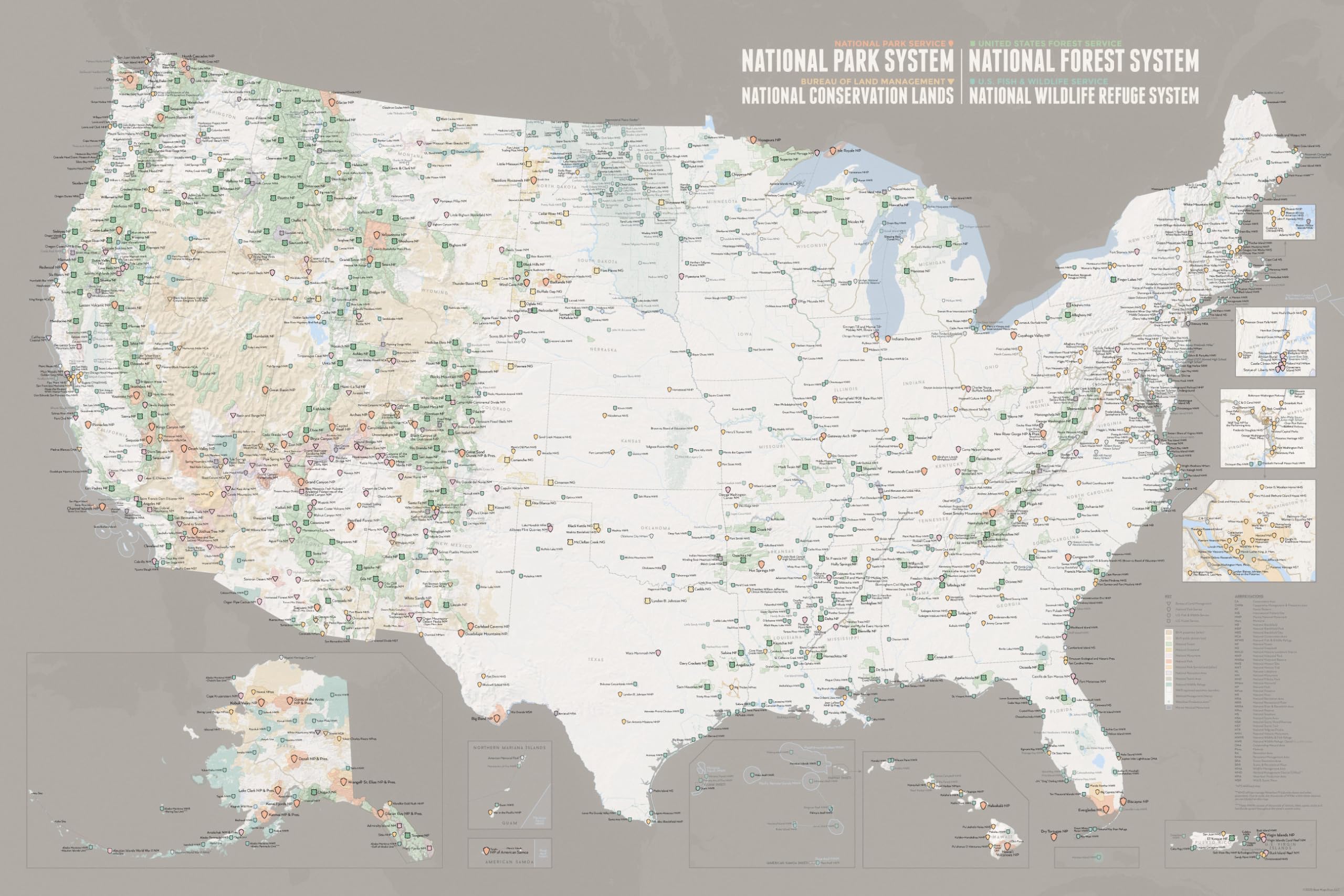
MORE THAN NATIONAL PARKS – ALL U.S. FEDERAL LANDS IN ONE MAP – Includes National Parks, Forest Service lands, BLM lands, and Fish & Wildlife areas—over 1300 public land units across the United States. See the full picture of America’s protected lands, not just the parks. DESIGNED FOR PLANNING, TRACKING & EXPLORATION – Plan road trips, track where you’ve been, and discover new destinations. Ideal for hiking goals, national park trips, and exploring public lands across the country. CLEAN, EASY-TO-READ CARTOGRAPHY – Clutter-free design with clear labeling and distinct colors for each land type. Quickly understand the map at a glance without overwhelming detail. CRISP DETAIL ON HEAVYWEIGHT SATIN PAPER – Printed with precision pigment inks for sharp detail and rich color. Smooth satin finish reduces glare and enhances readability. LARGE 24x36 FORMAT – READY TO DISPLAY OR FRAME – A bold, wall-sized map that fits standard 24x36 frames. Works as both functional wall art and a planning tool. Our Interagency Federal Lands Poster brings together all major U.S. public land systems on a single, beautifully designed map—including National Parks, National Forests, Bureau of Land Management lands, and Fish & Wildlife areas. The result is a complete view of the landscapes that define outdoor recreation in the United States. Whether you're planning your next trip, tracking where you've been, or simply appreciating the scale of protected land across the country, this map is designed to be both functional and visually refined. Clean cartography keeps the focus on what matters—clear distinctions between land types, easy-to-read labeling, and a layout that remains legible even at a distance. It’s detailed where it needs to be, without feeling cluttered. Printed on heavyweight satin photo paper using precision pigment inks, the map delivers crisp detail, rich color, and a smooth, low-glare finish. At 24x36 inches, it’s sized to stand out on your wall while remaining easy to frame. More than a map of national parks—this is a map of the full public lands system.
More Information
| Color | White & Gray |
| Size | 24" X 36" |
| Gtin | 4861573172299 |
| Age_group | ADULT |
| Condition | NEW |
| Gender | UNISEX |
| Material | Paper |
| Product_category | Gl_outdoors |
| Google_product_category | Sporting Goods > Outdoor Recreation |
| Product_type | Office Products > Office & School Supplies > Education & Crafts > Geography Materials > Maps |